Auckland is no stranger to flooding. From the devastating Anniversary Weekend floods of January 2023 and Cyclone Gabrielle through to the regular surface flooding events that affect suburbs across the region every winter, flood risk is a reality that hundreds of thousands of Aucklanders live with.
But flood risk is not evenly distributed across the city. Some suburbs experience flooding far more frequently and severely than others, and many Auckland property owners do not fully understand the level of risk their specific location carries. Whether you are a homeowner, a landlord, a property investor, or someone looking to buy in Auckland, understanding the city's flood-prone areas is essential for making informed decisions and protecting your property.
In this comprehensive guide, the team at iDry Restorations breaks down why Auckland floods, which suburbs face the greatest risk by zone, how to check your property's specific flood exposure, and what practical steps you can take to prepare.
Why Auckland Floods: Understanding the Causes
Auckland's flooding problem is driven by a combination of natural geography, climate patterns, and human development. Understanding these factors helps explain why certain areas are hit harder than others.
Rainfall Patterns and Climate
Auckland receives approximately 1,200 millimetres of rainfall per year, spread across around 137 rain days. While that average is not extreme by global standards, what makes Auckland vulnerable is the intensity of individual rainfall events. The city regularly experiences short-duration, high-intensity downpours — the type of rainfall that overwhelms drainage systems and causes rapid surface flooding.
Climate change is making these events more frequent and more severe. MetService and NIWA data show that Auckland's heaviest rainfall events are becoming more intense, delivering more water in shorter timeframes than historical averages would predict. The January 2023 Auckland Anniversary floods, which dropped approximately 249mm of rain on the city in a single day, were a stark demonstration of this trend.
Geography and Topography
Auckland's landscape is a major factor in its flood vulnerability. The region is characterised by:
- Numerous streams and waterways: Auckland has over 3,000 kilometres of streams, rivers, and urban waterways. Many of these run through residential areas, and properties near these waterways face the highest flood risk.
- Volcanic terrain: Auckland's volcanic field has created a landscape of hills, valleys, and natural basins. Water naturally flows downhill and collects in low-lying areas, many of which have been developed for housing.
- Low-lying coastal areas: Suburbs close to the Waitemata and Manukau Harbours, as well as coastal streams, are vulnerable to tidal flooding, storm surge, and the combined effect of high tides with heavy rainfall.
- Clay soils: Large parts of Auckland, particularly in the west and south, have heavy clay soils with low permeability. These soils absorb water slowly, causing more rainfall to run off across the surface rather than soaking into the ground.
Urbanisation and Impervious Surfaces
As Auckland has grown and densified, natural ground that once absorbed rainfall has been replaced with roofs, driveways, roads, and paved surfaces. These impervious surfaces prevent water from soaking into the ground and dramatically increase the volume and speed of stormwater runoff.
In heavily urbanised catchments, stormwater runoff can be five to ten times greater than in the same area before development. Auckland's stormwater network — much of which was designed and built decades ago for a less intensely developed city — simply cannot cope with the volume of water generated during heavy rainfall events.
Aging Infrastructure
Auckland's stormwater drainage system has been built incrementally over more than a century. Many pipes and culverts in older suburbs are undersized for current rainfall volumes, partially blocked by root intrusion or sediment, or in poor structural condition. When these systems are overwhelmed, water backs up and floods streets, properties, and buildings through overland flow paths that may run directly through residential sections.
Auckland's Most Flood-Prone Suburbs by Zone
Based on historical flood event data, Auckland Council flood plain mapping, and our own extensive experience responding to flood emergencies across the region, here is a breakdown of the suburbs most frequently affected by flooding in each zone.
West Auckland
West Auckland consistently ranks as the most flood-affected part of the Auckland region. The combination of clay soils, steep terrain that funnels water into valleys, and extensive stream networks makes this area particularly vulnerable.
Henderson — Henderson sits at the confluence of several stream catchments, and properties near Henderson Creek, Oratia Stream, and the Opanuku Stream are regularly affected by flooding. The town centre area, particularly around Railside Avenue and parts of Henderson Valley Road, has a long history of flooding events. Stormwater infrastructure in many parts of Henderson was designed for a much smaller town and has not kept pace with the area's rapid growth.
Te Atatu (Peninsula and South) — Te Atatu Peninsula is surrounded by water on three sides, with the Whau River and Henderson Creek catchments running through the area. Low-lying sections near the motorway interchange and along Tirimoana Road are among the most flood-prone areas in Auckland. Te Atatu South, sitting lower than the peninsula, faces similar issues with limited drainage capacity and proximity to waterways.
New Lynn — New Lynn straddles the Whau River and several tributary streams. The town centre area, which underwent significant redevelopment in the 2010s, has experienced multiple flooding events. While new infrastructure has improved conditions, surrounding residential streets in Avondale, Green Bay, and Blockhouse Bay remain susceptible, particularly where properties back onto stream corridors.
Glen Eden and Titirangi — These suburbs, nestled in the Waitakere foothills, receive some of Auckland's highest rainfall due to the orographic effect of the Waitakere Ranges forcing moisture-laden westerly winds upward. Properties in valley floors and near the numerous bush streams are at elevated risk.
Massey and Westgate — Rapid residential development in these areas has significantly increased stormwater runoff volumes. Properties near the Swanson Stream and in low-lying areas around Westgate are increasingly flood-affected, with new developments sometimes exacerbating flooding on neighbouring properties.
Local insight: West Auckland's clay soils become almost impermeable after sustained rain. During the January 2023 floods, some West Auckland properties experienced flooding despite being well away from any stream or waterway, purely from surface water runoff that had nowhere to go. This is known as "pluvial flooding" and is one of the hardest flood types to predict or manage.
South Auckland
South Auckland's flat terrain, extensive stream networks, and growing urbanisation make it one of the region's most flood-vulnerable zones.
Manurewa — Manurewa is traversed by the Manurewa Stream and sits within the Manukau Harbour catchment. Low-lying properties near the stream and in areas with poor drainage are regularly affected. Parts of Randwick Park and Browns Road are well-known flood hotspots. The area's predominantly clay soils compound the problem by preventing effective ground absorption.
Papakura — Papakura sits adjacent to the Papakura Stream and Slippery Creek. The Papakura town centre and surrounding residential streets have experienced significant flooding events, including major inundation during the January 2023 storms. Properties near the streams and in the lower-lying parts of the suburb are most at risk.
Otara — The Otara Creek and its tributaries flow through this suburb, creating flood risk along the waterway corridor. Parts of East Tamaki and the industrial areas to the south also experience flooding, which can affect residential properties downstream.
Mangere and Mangere Bridge — These suburbs sit on the flat, low-lying land around the Manukau Harbour. Proximity to the harbour means that tidal influence affects drainage capacity — during high tide events combined with heavy rain, stormwater cannot discharge effectively, leading to flooding. The Mangere Inlet and areas near the Puhinui Stream are particularly vulnerable.
Flat Bush and Ormiston — While relatively newly developed, parts of Flat Bush sit within flood plain areas of the Pakuranga Creek catchment. Some newer developments have been built with stormwater management infrastructure, but the sheer volume of development in this area has increased downstream flood risk.
Central Auckland
Central Auckland's flood risk might come as a surprise to some, but the city's oldest suburbs contain some of the most flood-vulnerable infrastructure in the region.
Ponsonby and Grey Lynn — These highly sought-after inner-city suburbs are built over some of Auckland's oldest stormwater infrastructure. Many pipes date from the early 1900s and are significantly undersized for current rainfall intensities and the level of hard surface coverage. The Grey Lynn/Ponsonby area sits in the Western Springs/Meola Creek catchment, and properties in low-lying parts of these suburbs experience regular surface flooding during heavy rain.
Freemans Bay — As the name suggests, this suburb was historically a bay, and much of it sits on reclaimed or very low-lying land. Stormwater from the surrounding slopes of Ponsonby and Herne Bay drains through Freemans Bay, and the area's limited capacity to handle large volumes of runoff makes it a consistent flood hotspot.
Auckland CBD — The CBD's extensive hard surfaces (roads, buildings, car parks) generate enormous volumes of stormwater runoff. During the January 2023 floods, streets in the CBD were turned into rivers, and underground car parks and lower levels of buildings were inundated. The Waihorotiu Stream, which runs beneath Queen Street in a buried pipe, is a significant flood risk when its capacity is exceeded.
Mt Roskill and Sandringham — Parts of these suburbs sit within the Oakley Creek (Te Auaunga) catchment, one of Auckland's longest urban streams. Properties near the creek corridor and in natural low points have experienced repeated flooding events.
Onehunga and Royal Oak — Low-lying areas near the Manukau Harbour and the One Tree Hill/Maungakiekie catchment are affected by both fluvial (stream) and pluvial (surface) flooding. The Onehunga foreshore area is also subject to tidal influence during storm events.
Is Your Auckland Property at Risk of Flooding?
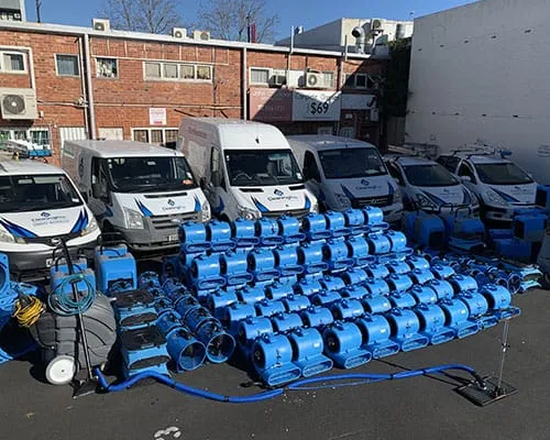
iDry Restorations provides 24/7 emergency flood response across all of Auckland. If your property has been affected by flooding, our IICRC-certified team can be on-site within 60 minutes for emergency water extraction and drying.
Call 0800 452 199 Get a Free QuoteNorth Shore
The North Shore's hilly terrain means flooding tends to be concentrated in specific valleys and low-lying coastal areas rather than spread broadly across the landscape.
Takapuna — Despite being one of Auckland's most affluent suburbs, Takapuna experiences regular flooding in low-lying areas near the Wairau Creek and along parts of the Lake Road corridor. The commercial centre, particularly around Hurstmere Road, has experienced surface flooding during intense rainfall events.
Northcote and Birkenhead — These suburbs are dissected by deep gullies that channel stormwater toward the harbour. Properties near the Onepoto Stream, Sulphur Beach Creek, and other waterway corridors face elevated flood risk. The hilly terrain means that flooding, when it occurs, can be sudden and fast-moving.
Glenfield and Bayview — The Wairau Valley catchment serves as a major drainage corridor for a large area of the North Shore. Properties in the Wairau Valley floor and near the Wairau Creek are among the most flood-prone on the Shore. The extensive commercial and industrial development in the valley has created large areas of impervious surface that generate significant runoff.
Milford and Castor Bay — Coastal erosion and stormwater runoff from steep hillside properties contribute to flood risk in lower-lying coastal areas. Properties near Wairau Creek as it approaches the coast are particularly vulnerable.
Albany and Oteha — Rapid development in the Albany area has increased stormwater volumes in the Lucas Creek and Oteha Stream catchments. While newer developments incorporate modern stormwater management, the cumulative effect of increased impervious surfaces has raised flood risk for properties downstream.
How to Check Your Property's Flood Risk
If you are concerned about your property's flood exposure — whether you are a current owner or looking to buy — there are several ways to assess the risk:
Auckland Council GeoMaps
Auckland Council's free online mapping tool (geomaps.aucklandcouncil.govt.nz) allows you to search for your property and view overlays including:
- Flood plains: Areas identified as being within the 1% Annual Exceedance Probability (AEP) flood extent — commonly referred to as the "100-year flood plain"
- Overland flow paths: The routes water takes across the surface during heavy rainfall when the stormwater system is overwhelmed
- Stream and waterway corridors: The location of all mapped streams, rivers, and watercourses near your property
- Coastal inundation zones: Areas at risk from sea level rise, storm surge, and tidal flooding
Land Information Memorandum (LIM) Report
A LIM report from Auckland Council provides comprehensive information about a specific property, including any known natural hazards such as flooding, overland flow paths, coastal erosion, and land instability. A LIM costs approximately $300-400 and is an essential document for property buyers. It will disclose if the property has been subject to flooding in the past or if it lies within a known flood hazard area.
Insurance Company Risk Data
Your insurance company holds detailed flood risk data for properties across Auckland. When obtaining or renewing a home insurance quote, ask your insurer directly about the flood risk rating for your specific address. Insurers like IAG, Tower, and Vero use sophisticated modelling that incorporates topography, drainage capacity, historical claims data, and climate projections. If your insurer applies a flood excess or flood exclusion to your policy, this is a strong signal that your property is in a higher-risk zone.
Historical Research
Talk to your neighbours, particularly long-term residents who can provide firsthand accounts of past flooding events. Check local community Facebook groups and forums where flood events are often well documented. Auckland Council's building consent records (available through the council website) may also contain references to past flood damage or flood-related building requirements.
What to Do If You Are in a Flood Zone
Living in a flood-prone area does not mean you are powerless. There are practical steps you can take to reduce your risk and minimise the impact of flooding if it does occur.
Property-Level Flood Protection
- Install non-return valves on your drainage pipes to prevent floodwater from backing up through your drains and into your property
- Raise electrical switchboards and power points above predicted flood levels where possible
- Waterproof your subfloor — install ground-level moisture barriers and ensure subfloor ventilation is adequate
- Grade your section so that surface water flows away from your house, not toward it
- Install sump pumps in basements or low-lying areas of your property
- Keep sandbags or flood barriers on hand if you are in a known flood area (Auckland Council provides sandbag stations during major events)
Maintenance Essentials
- Clear gutters and downpipes at least twice a year (before autumn and before winter). Blocked gutters are one of the most common causes of water damage to Auckland properties.
- Keep stormwater drains clear of leaves, debris, and sediment. Know where your stormwater drains are and check them before heavy rain is forecast.
- Maintain landscaping around your home to promote drainage. Avoid piling soil or garden materials against the house foundation.
- Check retaining walls for adequate drainage — blocked weep holes in retaining walls can cause water to build up behind the wall and seep into your property.
Flood Preparation Checklist
Every Auckland household in a flood-prone area should have a flood preparation plan. Here is a practical checklist:
- Emergency kit: Torches, batteries, battery-powered radio, first aid kit, bottled water, non-perishable food for at least three days
- Important documents: Keep copies of insurance policies, passports, birth certificates, and property documents in a waterproof container or bag, stored above potential flood level
- Know your shut-offs: Know how to turn off your water mains, electricity, and gas supply at the metre. Practice this so you can do it quickly in an emergency, even in the dark.
- Valuables off the floor: In garages, basements, and ground-level rooms, store valuable items on shelves or elevated platforms, not directly on the floor
- Emergency contacts: Keep the numbers for your insurance company, iDry Restorations (0800 452 199), Auckland Council, and emergency services readily accessible
- Evacuation plan: Know your nearest welfare centre and have a plan for getting there if your property is at risk of significant flooding. Identify a safe meeting point for your household.
- Vehicle safety: If flooding is forecast, move vehicles to higher ground. Never attempt to drive through floodwater — as little as 300mm of moving water can sweep a car off the road.
Critical safety note: During a flood event, never enter a flooded building until the electricity has been switched off at the mains. Water and electricity create a lethal combination. If you cannot safely access your switchboard, call your electricity provider to arrange disconnection.
Insurance Considerations for Flood-Prone Areas
Flood risk has become an increasingly important factor in New Zealand's insurance landscape. Here is what Auckland property owners in flood-prone areas need to know:
Standard Coverage
Most standard home insurance policies in New Zealand cover sudden and accidental flood damage, including damage from storms, burst pipes, and overflow events. This typically includes the cost of water extraction, structural drying, mould prevention, and reinstatement of damaged materials — all services that iDry Restorations provides and can bill directly to your insurer.
Increasing Premiums and Exclusions
Following the January 2023 floods and Cyclone Gabrielle, the New Zealand insurance industry has been reassessing flood risk across Auckland. Some property owners in known flood-prone areas have experienced:
- Significant premium increases for properties with flood claims history
- Higher excess amounts specifically for flood-related claims
- In some cases, flood exclusions being applied to policies for repeat-claim properties
- Tighter requirements around property maintenance and flood mitigation measures
What You Can Do
- Review your policy annually — do not assume last year's coverage still applies. Read the fine print on flood and natural disaster clauses.
- Document your property — keep a photographic record of your property's condition and your belongings. This is invaluable evidence if you need to make a claim.
- Invest in flood mitigation — some insurers offer reduced premiums for properties with demonstrable flood protection measures such as non-return valves, sump pumps, or raised floor levels.
- Get multiple quotes — flood risk assessments vary between insurers, so premiums and coverage terms can differ significantly for the same property.
- Work with experienced restorers — companies like iDry Restorations that have established relationships with insurers can help ensure your claim is properly documented and processed efficiently.
What to Do When Flooding Hits Your Property
If your Auckland property does experience flooding, taking the right steps in the first hours can dramatically reduce the extent of damage and the cost of restoration. For a detailed step-by-step guide, read our comprehensive article: What to Do After a Flood in Your Auckland Home.
The key immediate actions are:
- Ensure safety first — do not enter a flooded building until it is safe. Switch off electricity if you can safely access the switchboard.
- Document everything — take photos and videos of all damage before any cleanup begins. This evidence is critical for your insurance claim.
- Contact your insurer — lodge your claim as soon as possible.
- Call a professional restoration company — contact iDry Restorations on 0800 452 199. We respond 24/7 and can begin emergency water extraction and drying immediately.
- Do not attempt to dry the property yourself — domestic fans and dehumidifiers are not sufficient for flood damage. Professional-grade drying equipment and monitoring is essential to prevent mould growth and structural deterioration.
Auckland's Flood Future: What Property Owners Should Know
Looking ahead, Auckland's flood risk profile is expected to increase rather than decrease. The key drivers are:
- Climate change: More intense rainfall events, rising sea levels, and increased storm frequency will all contribute to higher flood risk across Auckland.
- Continued urbanisation: Auckland's population is projected to reach 2.4 million by the early 2040s. More development means more impervious surfaces and greater stormwater pressure.
- Aging infrastructure: Much of Auckland's stormwater infrastructure needs upgrading, and the investment required runs into billions of dollars over decades.
- Sea level rise: Even moderate sea level rise scenarios will increase tidal influence on coastal drainage, reducing the capacity of stormwater systems in coastal suburbs and increasing the frequency of coastal flooding.
Auckland Council is investing in flood management infrastructure, including upgraded stormwater pipes, detention ponds, and stream restoration projects. However, the scale of the challenge means that property-level flood resilience will remain essential for decades to come.
The Bottom Line: Know Your Risk, Be Prepared
Flooding is Auckland's most significant and most frequent natural hazard. Whether you live in a known flood-prone suburb or in an area that has never flooded before, understanding your property's risk and being prepared is essential.
The key takeaways from this guide:
- Check your property's flood risk using Auckland Council GeoMaps and your LIM report
- Understand your insurance coverage and ensure it is adequate for your actual risk level
- Take practical prevention steps including maintaining drainage, installing non-return valves, and keeping an emergency kit
- Have a plan for what you will do if flooding occurs, including who to call and how to shut off services
- Act fast if flooding does occur — professional restoration within the first hours dramatically reduces long-term damage and cost
iDry Restorations has responded to hundreds of flood events across every corner of Auckland. We understand the unique challenges that each suburb and zone presents, and our flood restoration services are designed to get your property dried, restored, and back to normal as quickly as possible. We also provide mould remediation Auckland services, which are frequently needed after flooding, as well as fire damage restoration, meth decontamination, and biohazard cleaning for contaminated properties. If you need help — now or in the future — contact our team on 0800 452 199. We are here 24/7.